One resource sadly lacking from the roleplaying game (as per this writing)
would be any detailed information on the size of the lands of Azeroth, and travel times to get
from one place to another.
For my own campaign, I've tried to develop some maps and other resources to assist in determining
travel times. These aren't very "pretty," as they're hacked together from screen
captures, with a bit of touch-up work based on various alternative sources. However,
I hope that this might provide a starting point for GMs running broad "overland"
campaigns.
Please note that, out of necessity, I've made a lot of arbitary assumptions, filling in various gaps.
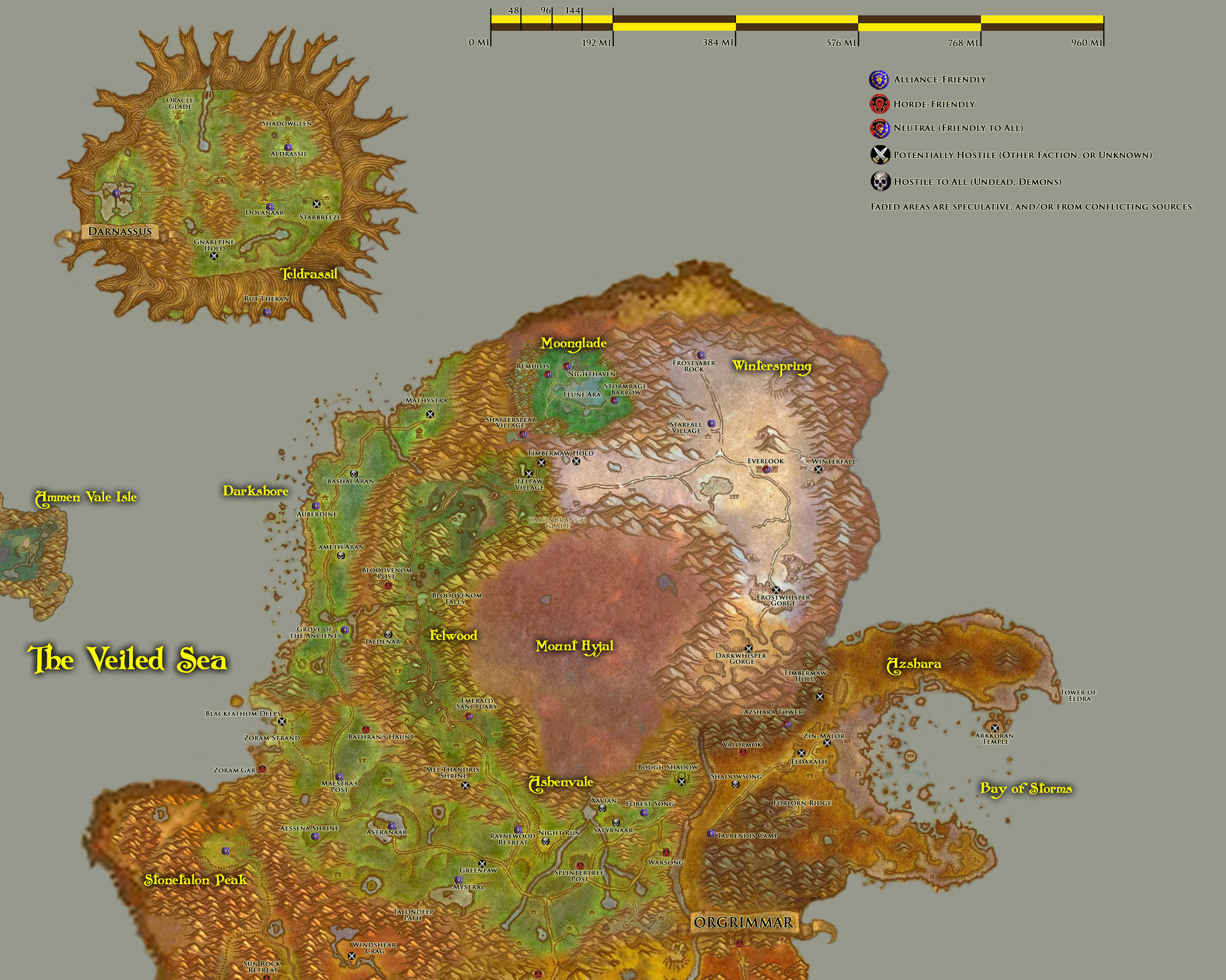
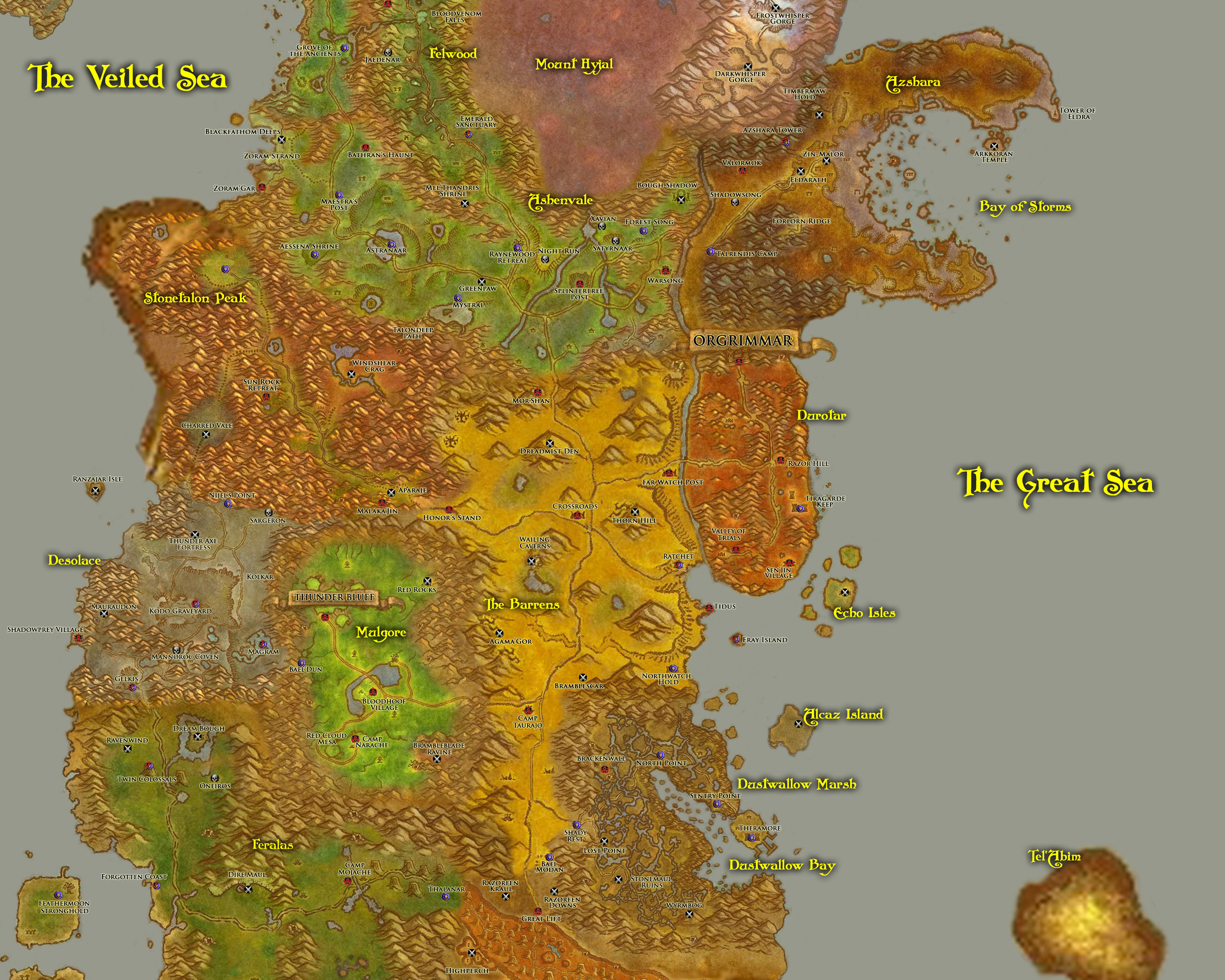
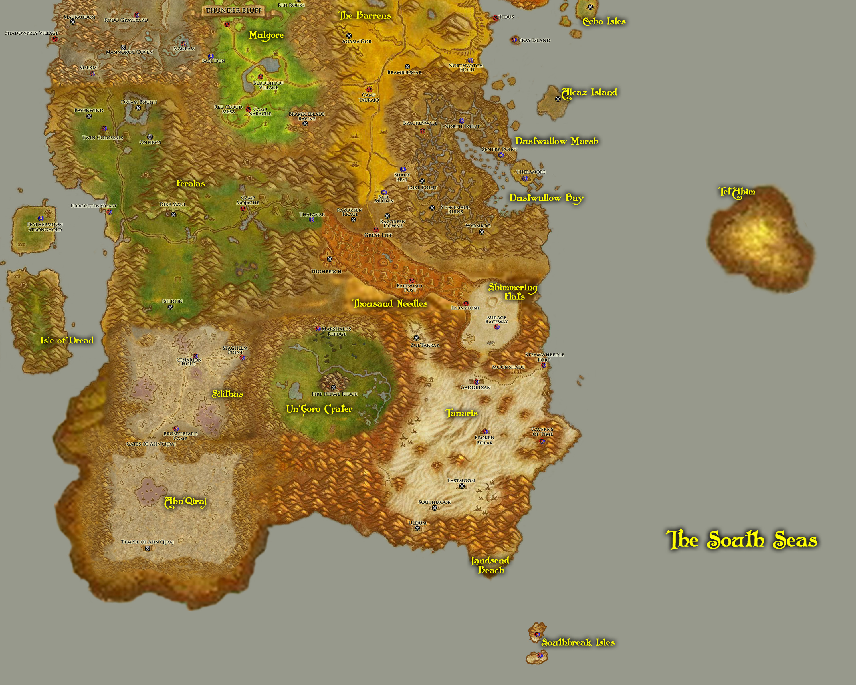
The scale of the maps is based upon a tidbit of information from the
White Wolf Forums, that Kalimdor is approximately 1600 miles
across, east to west, at its widest point. From that piece of information, I've extrapolated the
rest for my maps.
These maps are presented in the hopes of serving as a useful tool for GMs. They are (in their present
form) cobbled together from screen captures from World of Warcraft and the Warcraft RTS games, and I
have drawn heavily from the efforts of many other people. (Among these would be "Warlock", who put
together a comprehensive map of Azeroth
on his Scrolls of Lore web site. I've used his map as a
guideline for the placement of various islands, and for relative sizes of the continents.)
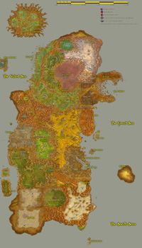
As of this writing, I only have Kalimdor and the Eastern Kingdoms done. The "no labels" alternate
versions are just the background without any of the labels I've added. (They may or may not include
some of the original "zone map" labels in whole or in part. In some places, I erased out the original
labels during the process of "zipping" the zone maps together and creating clear space to add my own
labels.)


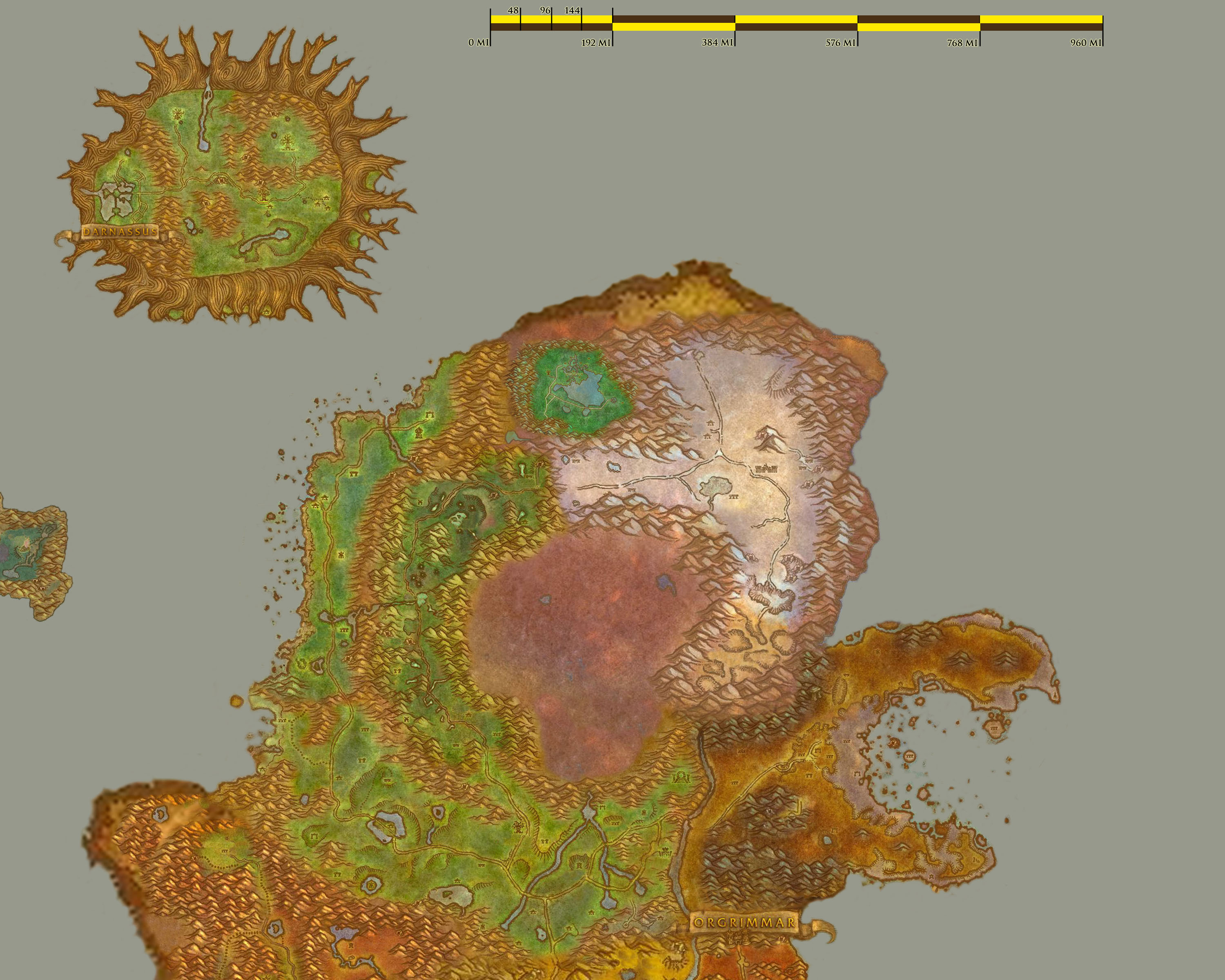
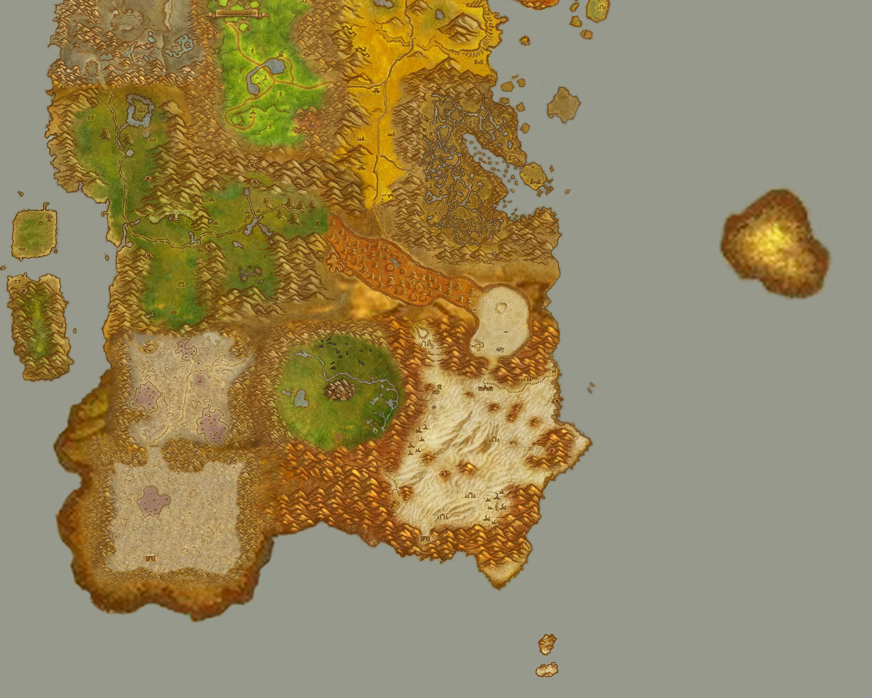
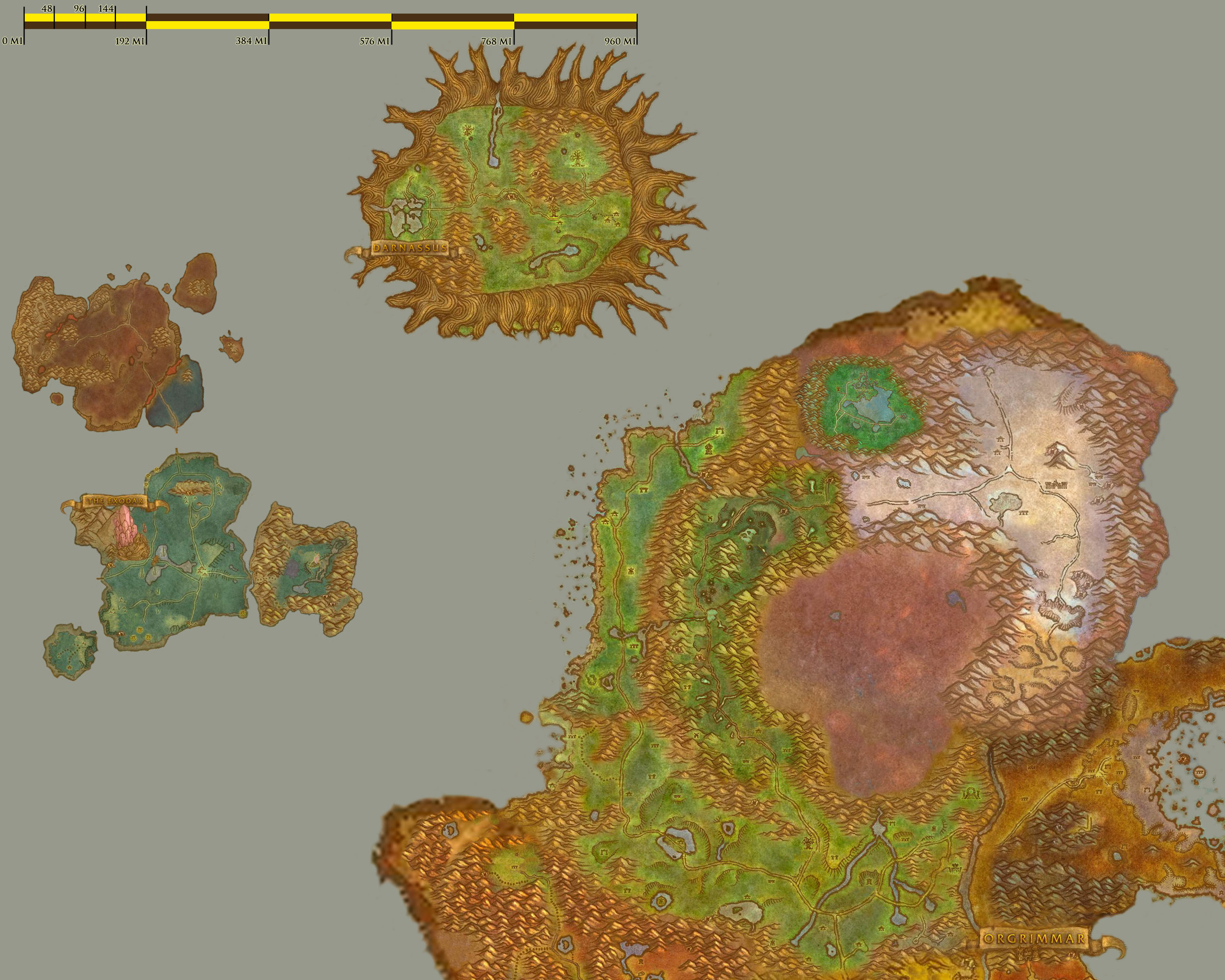
 This travel map is pieced together, using a low-resolution outline of Kalimdor (from the world map), and
then pasting in the individual zone maps (with some extrapolation made for areas not covered by the zone
maps). This is presented in three pieces (despite my attempts to fit it into two), meant to be printed off
at 300 dpi (8"x10" print area) in color. If you have access to Adobe Photoshop or a similar program, you
may want to adjust the contrast according to the peculiarities of your color printer. I've revised this
version (and the Eastern Kingdoms map below, too) to have each of the parts of equal size, despite the large
amount of overlap. (That makes it a little easier to print all the pieces at the same scale if you're using
a utility that automatically scales the pieces to fit the page.)
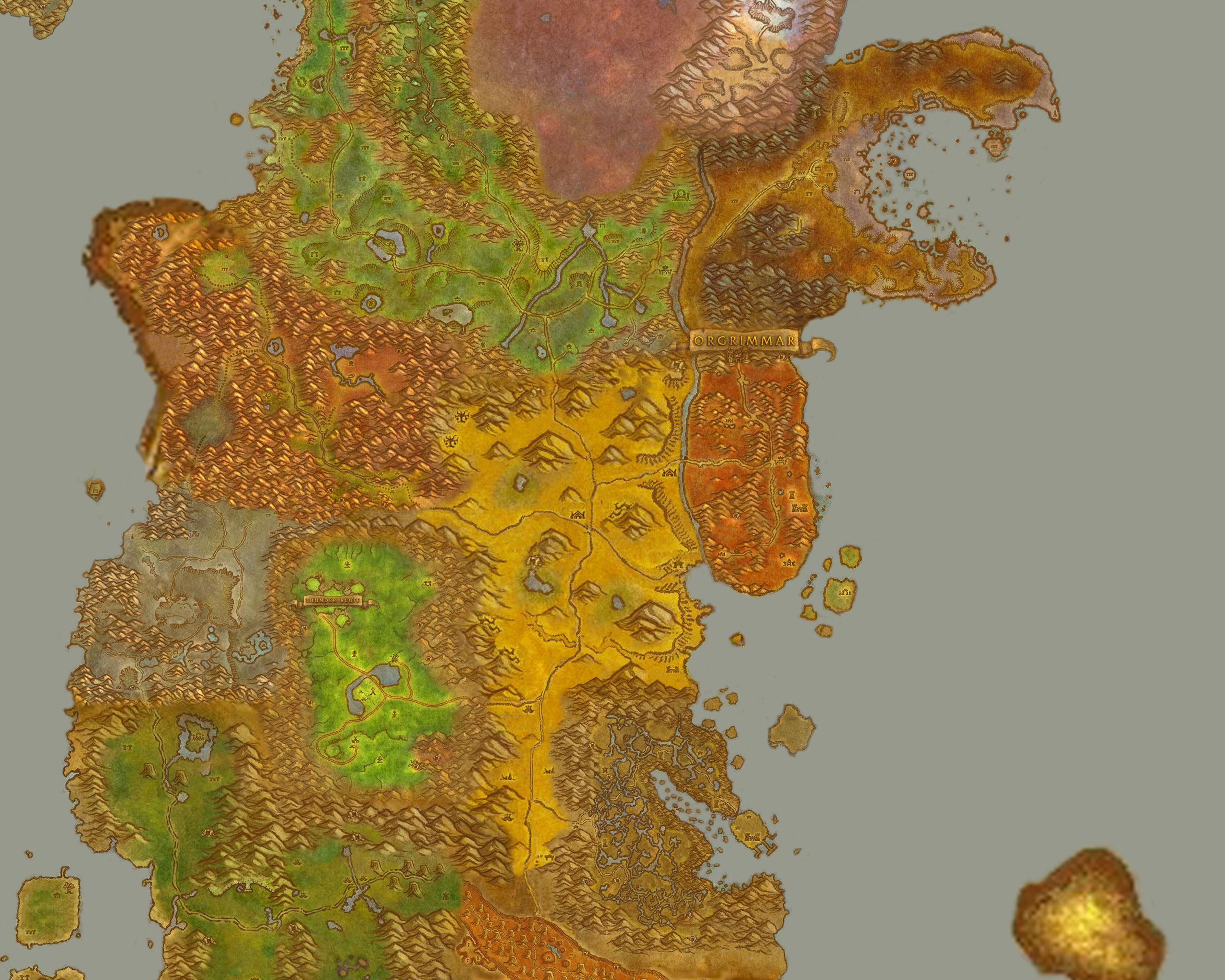
This travel map is pieced together, using a low-resolution outline of Kalimdor (from the world map), and
then pasting in the individual zone maps (with some extrapolation made for areas not covered by the zone
maps). This is presented in three pieces (despite my attempts to fit it into two), meant to be printed off
at 300 dpi (8"x10" print area) in color. If you have access to Adobe Photoshop or a similar program, you
may want to adjust the contrast according to the peculiarities of your color printer. I've revised this
version (and the Eastern Kingdoms map below, too) to have each of the parts of equal size, despite the large
amount of overlap. (That makes it a little easier to print all the pieces at the same scale if you're using
a utility that automatically scales the pieces to fit the page.)
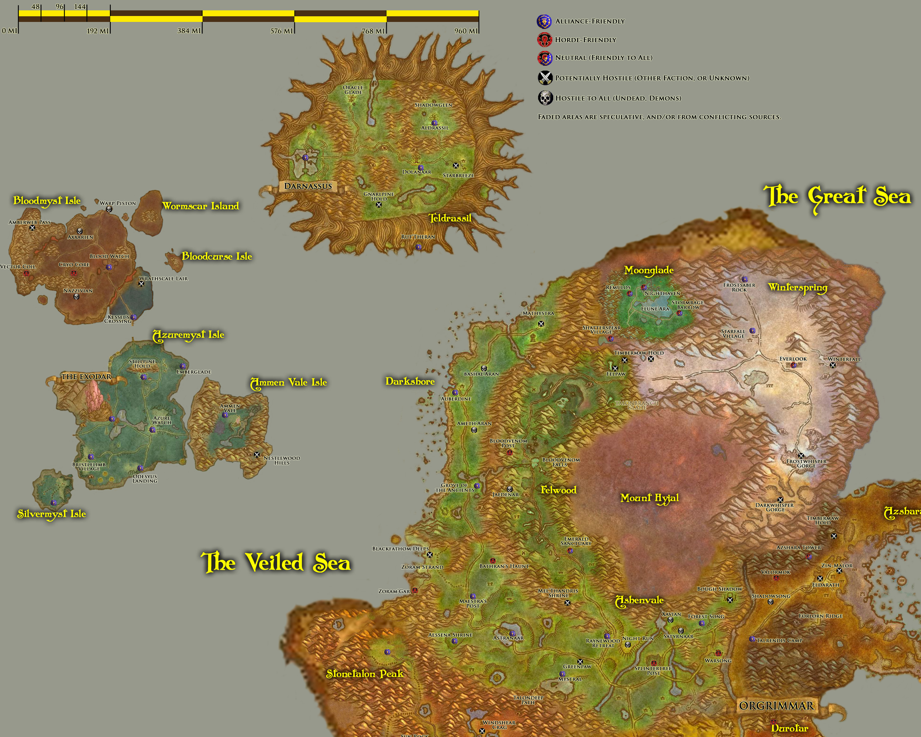
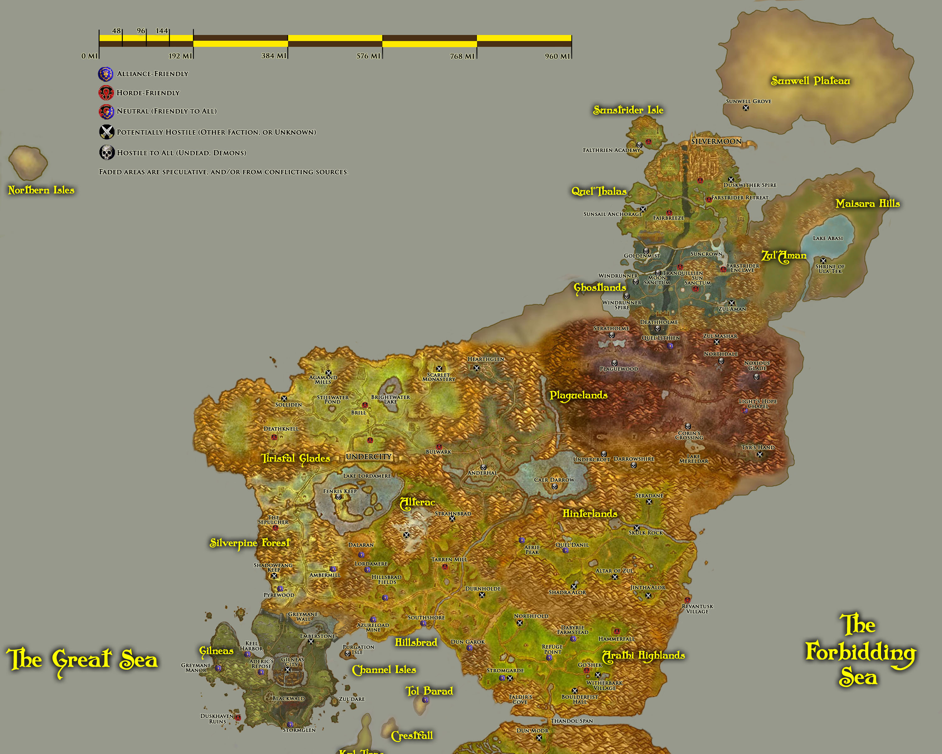
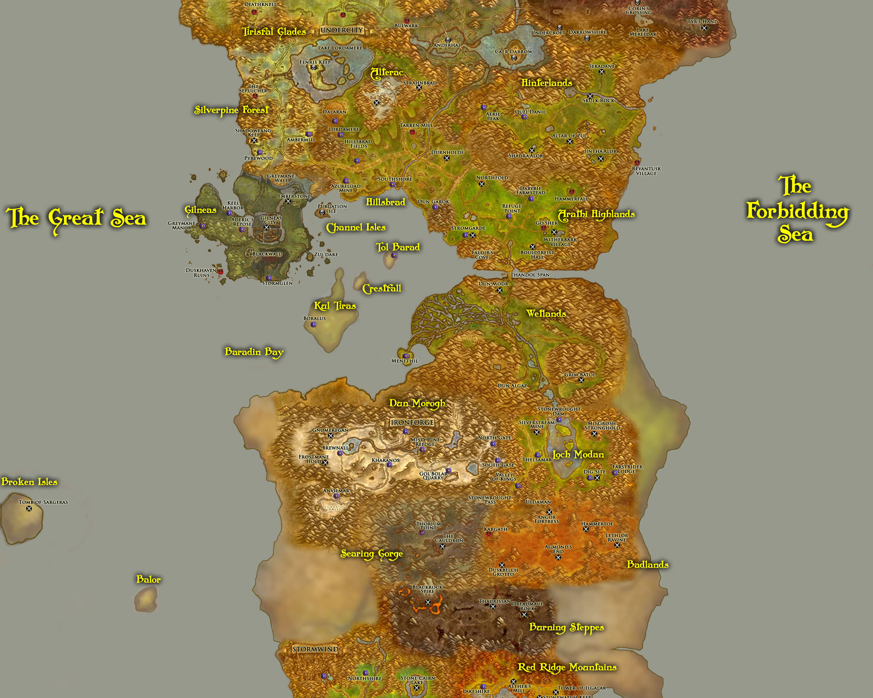
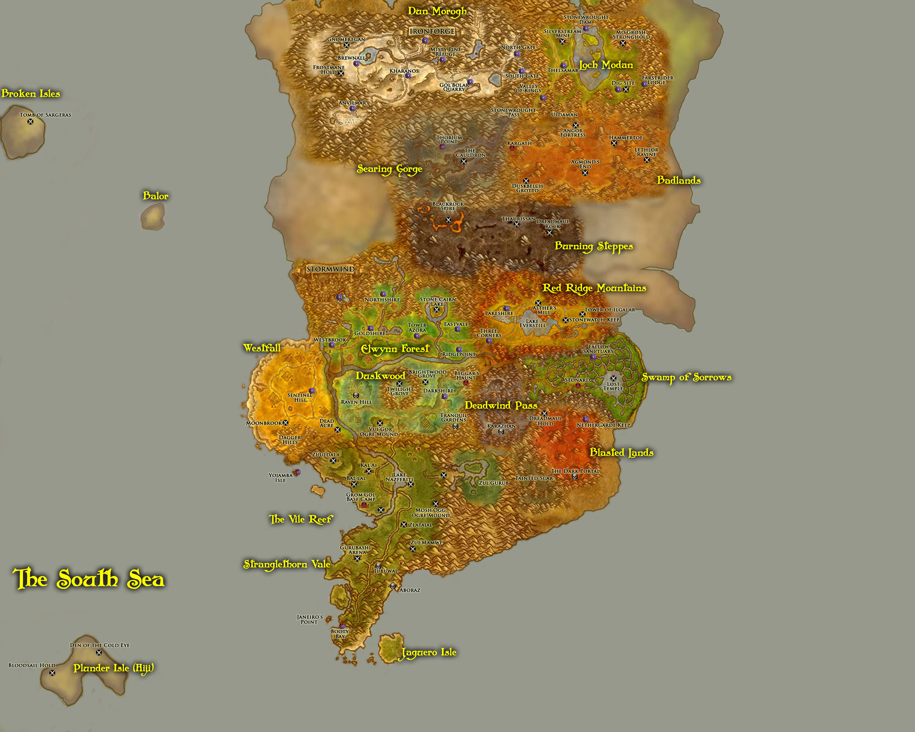
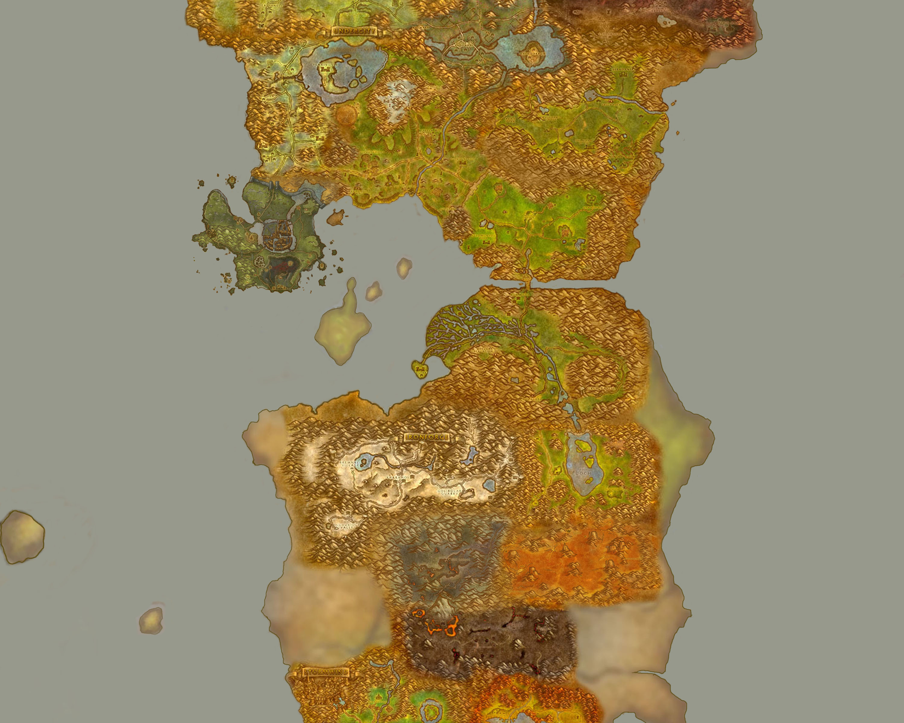
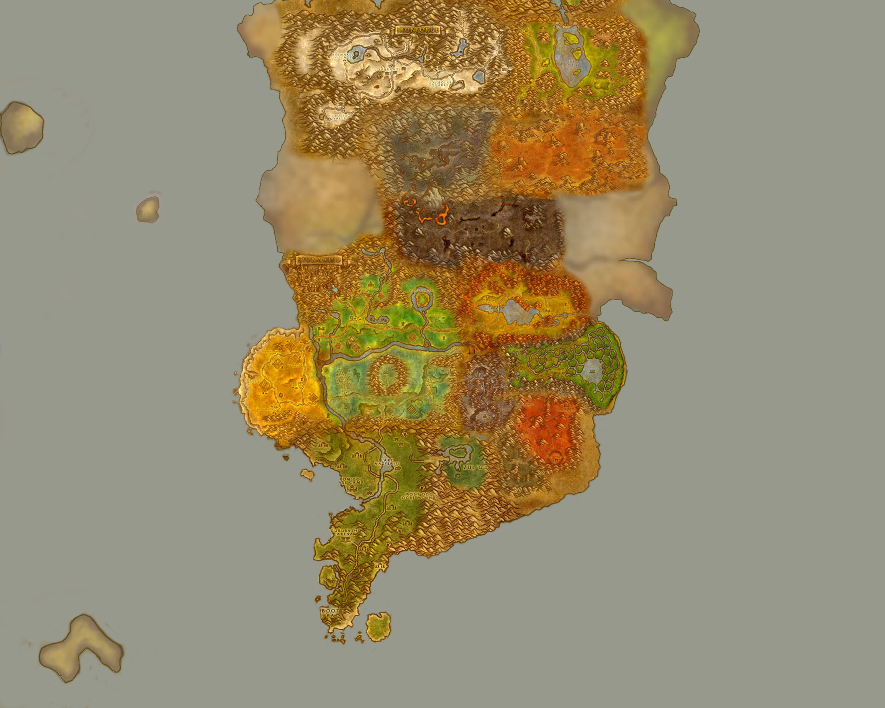
 This travel map was pieced together in similar fashion to the Kalimdor map, though I started with a "zone map"
I found during a Google search, and then I proceeded to make alterations from there (pasting in a few of my
own "zone maps" to scale things how I wanted, adding labels, adding icons, and drawing in missing islands and
the nation of Zul'Aman). Although I tried to add some outlines for greater clarity, there are several
"faded" areas: These represent areas part of the continents of the Eastern Kingdoms that aren't actually
covered by game-playable "zones" in World of Warcraft, or they represent areas that I've added in
(Kul Tiras, Zul'Aman, and assorted islands) that weren't covered by the World of Warcraft maps.
This travel map was pieced together in similar fashion to the Kalimdor map, though I started with a "zone map"
I found during a Google search, and then I proceeded to make alterations from there (pasting in a few of my
own "zone maps" to scale things how I wanted, adding labels, adding icons, and drawing in missing islands and
the nation of Zul'Aman). Although I tried to add some outlines for greater clarity, there are several
"faded" areas: These represent areas part of the continents of the Eastern Kingdoms that aren't actually
covered by game-playable "zones" in World of Warcraft, or they represent areas that I've added in
(Kul Tiras, Zul'Aman, and assorted islands) that weren't covered by the World of Warcraft maps.
